
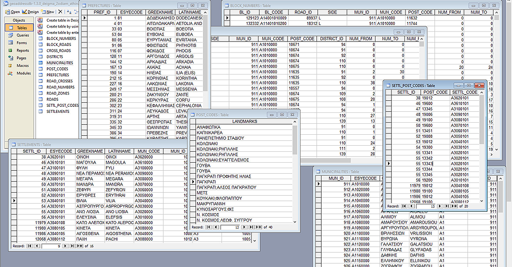
GEODATA has developed a unique database that links addresses to Postal Codes.

The fields included are:
- towns / villages,
- roads and numbers,
- Postal Codes.
The combinations of data that can be extracted are obviously numerous.
- Which roads are included in a Postal Code?
- For the selected roads, where does their numbering start and where does it end within the limits of the selected Postal Code?
- Verification of address and postal codes.
- Which Municipality (or Municipalities) does a Postal Code belong to?
- Which Postal Code does a neighborhood belong to?
- Which Postal Codes are included in a Municipality?
- Which settlements are included in a Postal Code?
This database can be customized and developed as a standalone application or software to avoid road / postcode typing.
So, for example in an e-shop, one could choose a Postcode which can generate a list of the contained streets, in order for data input to be faster and more efficient, avoiding typing errors.